Contacts
Info
Melbourne Florida Surf Report Your AI-powered source for Space Coast surf conditions! The "Melbourne Florida Surf Report" serves up essential updates tailored for surfers hitting the waves in the Space...
show more
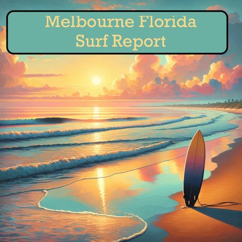
Melbourne Florida Surf Report
Your AI-powered source for Space Coast surf conditions!
The "Melbourne Florida Surf Report" serves up essential updates tailored for surfers hitting the waves in the Space Coast region. Using advanced AI technology to pull data directly from the National Weather Service, this podcast keeps you in the know.
Each episode delivers:
Hang loose, subscribe to the "Melbourne Florida Surf Report", and let's ride!
For more information check out https://www.quietperiodplease.com/
show less
Your AI-powered source for Space Coast surf conditions!
The "Melbourne Florida Surf Report" serves up essential updates tailored for surfers hitting the waves in the Space Coast region. Using advanced AI technology to pull data directly from the National Weather Service, this podcast keeps you in the know.
Each episode delivers:
- Essential Surfing Data: Get detailed reports on current wave height, swell direction and period, wind patterns, and water temperature.
- Tailored for Melbourne: Specific insights on how the conditions will translate at popular breaks around Melbourne Beach, Sebastian Inlet, and Cocoa Beach.
- Beyond the Basics: Our AI system will analyze the data to suggest the best spots depending on your skill level and the day's forecast.
- Tide Times: Never miss a session by staying informed about tide changes, a critical factor on the Space Coast.
- Community Connection (Development Phase): We're working on incorporating local knowledge, tips, and up-to-the-minute observations from Melbourne's passionate surf community.
- Space Coast Surfers: Your go-to for daily info delivered directly and conveniently.
- Wave-Chasing Visitors: Eliminate guesswork and maximize your surf time while visiting Melbourne.
- Ocean Enthusiasts: Tune in for the latest on the coastal environment and wave conditions.
Hang loose, subscribe to the "Melbourne Florida Surf Report", and let's ride!
For more information check out https://www.quietperiodplease.com/
Surf Report for Melbourne Florida
Surf Report for Melbourne Florida
-
Melbourne, FL for 05-11-2024
11 MAY 2024 · Hey there surfers and beachgoers! Ready to catch some waves and soak up the sun? Let's dive into the surf zone forecast for the East Coast of sunny Florida! Today in Daytona Beach, New Smyrna Beach, and Canaveral National Seashore, we're looking at a moderate risk of rip currents, with surf heights around 2 feet. The UV index is very high, so don't forget your sunscreen as temperatures rise into the mid-80s. It'll be partly cloudy in the morning, mostly sunny around noon, and then partly cloudy again later. North winds at 5 to 10 miles per hour will keep things breezy. Tomorrow, expect a similar setup with moderate rip current risks and 2-foot surf heights. The morning will be mostly sunny, then partly cloudy as temperatures dip slightly into the lower 80s with gentle northeast winds. And looking ahead to Monday to Wednesday, we're anticipating partly cloudy skies with a chance of showers and thunderstorms. Highs will be in the mid to upper 80s, with southeast to southwest winds around 10 to 15 miles per hour. Over in Vero Beach, Cocoa Beach, Satellite Beach, and Melbourne Beach, today brings a moderate rip current risk, 2-foot surf heights, and very high UV index. The day will start mostly cloudy, becoming partly cloudy with a slight chance of showers and thunderstorms. Temperatures will climb into the upper 80s with northwest winds shifting to the north. Sunday will see a repeat of moderate rip currents and 2-foot waves. Partly cloudy skies in the morning will give way to mostly sunny conditions before turning partly cloudy again. Highs will be in the mid-80s with northeast winds. For Fort Pierce Inlet, Jensen Beach, St. Lucie Inlet, and Hobe Sound, get ready for a mix of clouds and sunshine today. Moderate rip currents, 2-foot waves, and an extreme UV index. There's a chance of showers and a slight chance of thunderstorms as temperatures reach the upper 80s. West winds become northeast in the afternoon. Sunday's forecast includes a moderate rip current risk, 2-foot surf, and partly cloudy weather with temperatures in the mid-80s and northeast winds. So plan your beach day accordingly, stay safe in the water, and soak in that gorgeous Florida sunshine! This has been a Quiet Please Studios audio creation with the help of AI. Please subscribe and never miss a swell! Thank you for listening.2m 29s -
Melbourne, FL for 05-10-2024
10 MAY 2024 · Hey there, surfers and beach lovers! Get ready for your daily dose of surf zone forecast fun. Let's dive into the waves for today, tomorrow, and the weekend ahead. Starting off with today at the beaches of Ormond Beach, Daytona Beach, New Smyrna Beach, and Canaveral National Seashore in Florida: Rip Current Risk is moderate, so be cautious out there. Surf height around 2 feet, not bad for a chill day by the water. The UV index is very high, so don't forget that sunscreen! Water temperature is in the mid-70s, perfect for a refreshing dip. Expect partly cloudy skies with a chance of showers and thunderstorms. High temps in the lower 90s with southwest winds around 10 mph. Moving on to Saturday, still in the same area: Rip Current Risk remains moderate. Surf height around 2 feet, great for some easy rides. Weather starts partly cloudy then turns mostly sunny later on. High temps in the lower 80s with north winds at 10 to 15 mph. Tides are looking good at Daytona Beach and Port Canaveral, so plan your surf sessions accordingly. And for Sunday through Tuesday, expect some partly cloudy skies, a chance of showers and thunderstorms, and temperatures in the 80s to low 90s. Make sure to check the updated forecast for detailed info as your surf days approach. For Vero Beach, Cocoa Beach, Satellite Beach, and Melbourne Beach in Florida: Similar conditions with moderate rip current risk, 2-foot surf height, very high UV index, and mid-70s water temperature. Partly cloudy turning mostly sunny later, highs in the mid-90s, and southwest winds at 10 to 15 mph. On Saturday, surfers can expect a moderate rip current risk with similar conditions and winds shifting from west to north later in the day. And looking ahead to Sunday through Tuesday, anticipate some showers and thunderstorms, so keep an eye out for changes in the weather patterns. Remember, always check for updates and stay safe out there in the water. This has been a Quiet Please Studios audio creation with the help of AI. Please subscribe and never miss a Swell! Thank you for listening.2m 13s -
Melbourne, FL for 05-09-2024
9 MAY 2024 · Hey there, surfers and beachgoers! Ready to catch some waves and soak up the sun? Well, here's your surf zone forecast for the lovely beaches along the Florida coastline. Today, expect a moderate rip current risk with surf heights around 2 to 3 feet. The UV index is very high, so don't forget that sunscreen! The water temperature is in the mid 70s with sunny weather and temperatures reaching the upper 80s. Winds will be coming from the south at around 10 miles per hour. Tomorrow, the rip current risk remains moderate with surf heights around 2 feet. The day starts partly cloudy, then turns mostly cloudy before becoming partly cloudy again with a slight chance of showers and thunderstorms. Highs will be in the lower 90s with southwest winds at 10 to 15 miles per hour. As we head into the weekend, Saturday will be partly cloudy with highs in the lower 80s and north winds around 10 miles per hour. Sunday looks mostly sunny with highs in the lower 80s and northeast winds around 10 miles per hour. Monday brings partly cloudy skies with a chance of showers and thunderstorms and highs in the lower 80s with southeast winds around 10 miles per hour. The rip current risk remains moderate across the weekend, so stay safe out there in the surf zone. And remember, life-threatening rip currents are always possible, especially near jetties and piers. So, grab your boards, pack your sunscreen, and get ready for some fun in the sun on the beautiful Florida beaches! This has been a Quiet Please Studios audio creation with the help of AI. Please subscribe and never miss a Swell! Thank you for listening.1m 45s -
Melbourne, FL for 05-08-2024
8 MAY 2024 · Ahoy there, surfers and beachgoers! It's time for your daily surf zone forecast straight from the sandy shores! Let's dive in! Today, over at Coastal Volusia, Mainland Northern Brevard, and the Northern Brevard Barrier Islands, we're looking at a moderate rip current risk, with surf heights around 2 feet and a very high UV index. The water temperature is in the mid 70s, so grab that sunscreen! Expect a sunny day with highs in the mid 80s and a gentle South wind blowing at 5 to 10 miles per hour. Perfect conditions to catch some waves! Tomorrow, the rip current risk remains moderate with slightly higher surf heights of 2 to 3 feet. The weather will be mostly sunny with temperatures in the upper 80s and South winds at around 10 mph. Don't forget to check out those tides for Daytona Beach and Port Canaveral if you're planning a surf session! And looking ahead to the weekend, get ready for some fun in the sun! Friday brings the chance of showers and thunderstorms with temperatures in the upper 80s. Saturday offers a slight chance of rain with highs in the lower 80s, and Sunday will be mostly sunny with temperatures also in the lower 80s. Winds will vary, so keep an eye on those conditions! Moving over to Coastal Indian River, Mainland Southern Brevard, and the Southern Brevard Barrier Islands, we're seeing similar conditions with moderate rip current risks, around 2 feet surf heights, and a very high UV index. It's sunny today with highs in the upper 80s and Southeast winds at 10 to 15 mph. For those sunrise and sunset chasers, times are 6:37 AM and 8:01 PM, respectively. Thursday brings around 3 feet surf heights, a mix of sun and clouds, and continued moderate rip current risks. Make the most of those South winds at 10 to 15 mph for a great day out on the water! And as we head into the weekend, expect warm temperatures, a chance of showers, and thunderstorms on Friday, and a mix of sun and clouds with varying wind directions on Saturday and Sunday. So there you have it, a mix of sun, surf, and maybe a few showers in the forecast! Remember to stay safe, watch out for those rip currents, and enjoy the beautiful beaches of Florida! This has been a Quiet Please Studios audio creation with the help of AI. Please subscribe and never miss a Swell! Thank you for listening.2m 29s -
Melbourne, FL for 05-07-2024
7 MAY 2024 · Ahoy there, surfers and beach lovers! This is your go-to surf forecast report brought to you by the National Weather Service in Melbourne, FL. Let's dive into the groovy waves waiting for you: For our buddies hanging out at Coastal Volusia, Mainland Northern Brevard, and Northern Brevard Barrier Islands, here's the scoop: Today’s surf height is around 2 feet with a moderate rip current risk, so stay sharp out there. The UV index is very high, so don't forget your sunscreen! Expect mostly sunny skies turning partly cloudy later on with temperatures hitting the mid-80s. South winds will be cruising at 5 to 10 miles per hour. Wednesday keeps the moderate rip current risk and the 2-feet surf height, so get ready for another sunny day! Moving to our pals at Coastal Indian River, Mainland Southern Brevard, and Southern Brevard Barrier Islands: Today's surf height loiters around 2 feet with a moderate rip current risk and a very high UV index. It's going to be a mostly sunny day, with temperatures soaring to the mid-80s. Winds will start gentle and increase to a southeast breeze up to 15 miles per hour in the afternoon. On Wednesday, the surf height creeps up to 2-3 feet, keeping that moderate rip current risk. Get ready for more sunny goodness with temperatures reaching the upper 80s! So, beachgoers, enjoy the waves, soak up the sun, and always keep an eye on those rip currents. Be sure to check out the link provided for more info on thunderstorms, waterspouts, and UV risks. This has been a Quiet Please Studios audio creation with the help of AI. Please subscribe and never miss a Swell! Thank you for listening.1m 43s -
Melbourne, FL for 05-06-2024
6 MAY 2024 · Hey there fellow surfers and beachgoers, this is your go-to surf forecast for the beautiful beaches of Coastal Volusia, Mainland Northern Brevard, Northern Brevard Barrier Islands, Coastal Indian River, Mainland Southern Brevard, Southern Brevard Barrier Islands, Coastal Saint Lucie, and Coastal Martin. Let's dive into the fun coming your way! For today, expect a moderate rip current risk, with surf heights around 2 feet. The UV index is very high, so make sure to lather up that sunscreen. The water temperature is in the mid 70s, perfect for a refreshing dip. The weather will be partly cloudy with a slight chance of showers and thunderstorms, so keep an eye out. High temperatures will be in the lower 80s, with Southeast winds blowing at 10 to 15 miles per hour. Don't forget to catch that sunrise at 6:38 AM and the beautiful sunset at 8:04 PM. As we paddle into Tuesday, the rip current risk decreases to low, and surf heights remain around 2 feet. The day will start partly cloudy and transition to mostly sunny, with a slight chance of showers and thunderstorms. High temperatures will be in the mid 80s, and South winds will be blowing at 5 to 10 miles per hour. Catch that sunrise at 6:37 AM and the sunset at 8:04 PM. Looking ahead to Wednesday through Friday, expect mostly sunny and sunny days with highs in the mid to lower 90s. Winds will be predominantly South and Southwest at around 10 to 15 miles per hour. So, get ready for some great beach weather and waves to hit the shores! Remember to check the link for more info on the rip current risk categories and keep an eye out for those life-threatening currents, especially near jetties and piers. And most importantly, stay safe and have a blast out there, surfers! This has been a Quiet Please Studios audio creation with the help of AI. Please subscribe and never miss a Swell! Thank you for listening.2m 3s -
Melbourne, FL for 05-05-2024
5 MAY 2024 · Hey there, beachgoers! Ready for some fun in the sun and surf? Let's dive into the latest surf zone forecast for the coastlines of Florida! Today looks like a mixed bag of weather at the Coastal Volusia area. We've got a moderate rip current risk, waves around 2 feet high, a very high UV index, and temperatures in the lower 80s. So, slap on that sunscreen, catch some waves, and keep an eye out for the chance of showers and thunderstorms later in the day. Moving on to Monday, expect more of the same with a moderate rip current risk, 2-foot waves, and temperatures in the lower 80s. It's a perfect day to soak up the sun and enjoy the surf! For all you surfers at Coastal Indian River, you're in for a treat. Similar conditions with a moderate rip current risk, 2-foot waves, and highs in the mid-80s. Make the most of the partly cloudy sky and slight chance of showers in the afternoon. As we look ahead to the rest of the week, expect mostly sunny skies, temperatures climbing into the mid to upper 80s, and the surf remaining consistent. So, grab your boards, wax them up, and get ready for some epic sessions in the water! Remember to always stay safe, keep an eye out for those rip currents, and most importantly, have a blast out there, surfers! And this concludes our surf forecast report for the day. Catch you out on the waves! This has been a Quiet Please Studios audio creation with the help of AI. Please subscribe and never miss a Swell! Thank you for listening.1m 28s -
Melbourne, FL for 05-04-2024
4 MAY 2024 · Ahoy, surfers and beach lovers! Ready to catch some waves and soak up the sun? Let's dive into the surf zone forecast for the beautiful beaches of the East Coast, specific to the areas around Northern Brevard, Indian River, and Saint Lucie. Today looks like a day made for the beach - with a moderate rip current risk, around 2 feet of surf height, and a very high UV index. The water temperature is in the mid-70s, making it perfect for a refreshing swim. Expect partly cloudy skies turning mostly sunny by noon, with a high temperature in the lower 80s. Make sure to check out those tides and plan your day accordingly! Tomorrow, the surf conditions remain pretty consistent with a chance of showers and thunderstorms rolling in later in the day. Highs will still be in the lower 80s, so it's a great opportunity to enjoy the waves and maybe catch some lightning in the sky! Looking ahead to Monday through Wednesday, get ready for some classic beach weather with a mix of sun, clouds, and a slight chance of showers and thunderstorms. Highs will be in the mid-80s, so pack that sunscreen and get ready to bask in the sunshine. Remember, always keep an eye out for rip currents - especially around jetties and piers. And if you're curious about those UV index, thunderstorm, and waterspout definitions, check out the link provided in the forecast. So wax up those boards, grab your beach gear, and get ready for some fun in the sun at your favorite East Coast beaches! This has been a Quiet Please Studios audio creation with the help of AI. Please subscribe and never miss a Swell! Thank you for listening.1m 31s -
Melbourne, FL for 05-03-2024
3 MAY 2024 · Hey there, surfers and beach lovers! Ready to catch some waves and soak up the sun? Let's dive into the surf zone forecast for the coastal areas of Florida! Today, we're looking at moderate rip current risks, with surf heights around 2 feet. The UV index is very high, so don't forget your sunscreen! Expect partly cloudy skies in the morning, clearing up to mostly sunny later on. High temperatures will be around 80, with east winds at 5 to 10 miles per hour. Moving on to Saturday, similar conditions persist with a chance of showers and thunderstorms in the afternoon. Surf heights remain around 2 feet, with temperatures in the lower 80s and southeast winds picking up to 5 to 10 miles per hour. As we look into Sunday, Monday, and Tuesday, we can expect mostly sunny skies with a slight chance of showers and thunderstorms. Highs will be in the lower to mid-80s, with southeast winds around 10 miles per hour. So, grab your boards, wax up, and get ready for some fun in the sun at beautiful spots like Ormond Beach, Daytona Beach, and more! Remember, safety first - keep an eye on those rip currents. This has been a Quiet Please Studios audio creation with the help of AI. Please subscribe and never miss a Swell! Thank you for listening.1m 12s -
Melbourne, FL for 05-02-2024
2 MAY 2024 · Hey there surfers and beachgoers! Ready to catch some waves and soak up the sun? Let's dive into the surf zone forecast for our favorite spots along the Florida coast! Today, we're looking at moderate rip current risks at Coastal Volusia, Mainland Northern Brevard, and Northern Brevard Barrier Islands. With surf heights around 2 feet, it's the perfect day to paddle out! Don't forget your sunscreen; the UV index is very high. Expect partly cloudy skies clearing up to mostly sunny later on with temps in the lower 80s and east winds of 5 to 10 mph. Tomorrow, the rip current risk remains moderate with similar surf heights and weather conditions. It's a beach day for sure, with a high around 80 degrees and east winds keeping things breezy. For the weekend, get ready for more fun in the sun as we forecast partly cloudy skies on Saturday and a slight chance of showers and thunderstorms on Sunday. Temps stay in the lower 80s with east to southeast winds around 10 mph. Remember to check out the tides for Daytona Beach and Port Canaveral before heading out to the swell. And as always, stay safe and have a blast out there on the waves! This has been a Quiet Please Studios audio creation with the help of AI. Please subscribe and never miss a Swell! Thank you for listening.1m 14s
Melbourne Florida Surf Report Your AI-powered source for Space Coast surf conditions! The "Melbourne Florida Surf Report" serves up essential updates tailored for surfers hitting the waves in the Space...
show more
Melbourne Florida Surf Report
Your AI-powered source for Space Coast surf conditions!
The "Melbourne Florida Surf Report" serves up essential updates tailored for surfers hitting the waves in the Space Coast region. Using advanced AI technology to pull data directly from the National Weather Service, this podcast keeps you in the know.
Each episode delivers:
Hang loose, subscribe to the "Melbourne Florida Surf Report", and let's ride!
For more information check out https://www.quietperiodplease.com/
show less
Your AI-powered source for Space Coast surf conditions!
The "Melbourne Florida Surf Report" serves up essential updates tailored for surfers hitting the waves in the Space Coast region. Using advanced AI technology to pull data directly from the National Weather Service, this podcast keeps you in the know.
Each episode delivers:
- Essential Surfing Data: Get detailed reports on current wave height, swell direction and period, wind patterns, and water temperature.
- Tailored for Melbourne: Specific insights on how the conditions will translate at popular breaks around Melbourne Beach, Sebastian Inlet, and Cocoa Beach.
- Beyond the Basics: Our AI system will analyze the data to suggest the best spots depending on your skill level and the day's forecast.
- Tide Times: Never miss a session by staying informed about tide changes, a critical factor on the Space Coast.
- Community Connection (Development Phase): We're working on incorporating local knowledge, tips, and up-to-the-minute observations from Melbourne's passionate surf community.
- Space Coast Surfers: Your go-to for daily info delivered directly and conveniently.
- Wave-Chasing Visitors: Eliminate guesswork and maximize your surf time while visiting Melbourne.
- Ocean Enthusiasts: Tune in for the latest on the coastal environment and wave conditions.
Hang loose, subscribe to the "Melbourne Florida Surf Report", and let's ride!
For more information check out https://www.quietperiodplease.com/
Information
| Author | QP3 |
| Categories | Daily News |
| Website | - |
| corboo@mac.com |
Copyright 2024 - Spreaker Inc. an iHeartMedia Company
